Wilding The Sheaf: Sun 7th April 2024
A short stroll by the Sheaf: the past and possible future of an urban river. And are Sheffield's roadside verges at risk?
Morning. Last Sunday’s post about unpleasant river matters was picked up by other media later in the week.
You read it here first, remember, all thanks to the wonderful people who’ve realised it’s their contributions of £4 a month that pay the bills and keep these posts coming for all of you.
We’re not aiming to be a frenetic exclusive-chasing news machine, of course, but we do get there first quite often. The local 15 minute city explainer, for example, as posted here a year ago. (There’s more on this in our just updated April edition of Round at Bill’s Mother’s for full members).
Watch out for other media outlets picking up on the ‘what are people who should know better doing to our ancient woodlands’ story brought to us by Ian Rotherham last week in the run up to his Trouble In The Woods conference later in April.
This week I have a follow up about our rivers, thanks to the Sheaf and Porter Rivers Trust, which might answer a few questions raised in last week’s comments. And a strange and sad story about skips, pansies, big trucks and old grass verges.
Wilding Back The Sheaf
I’m on an insalubrious footpath over the River Sheaf, which once led to an idyllic place known only as ‘The Primrose’, says Simon Ogden of the Sheaf and Porter Rivers Trust (SPRT).
“The footpath that leads on from here is still called Primrose,” he tells me.
His colleague from SPRT, Andy Buck, later sends me a detailed 1894 map showing The Primrose meadow nestling by the meandering River Sheaf, where these days there’s an MOT centre and carpet shop. I’m here with Simon and Andy to learn a little about the river that named our city, and how we’ve tried to tame it over the years.
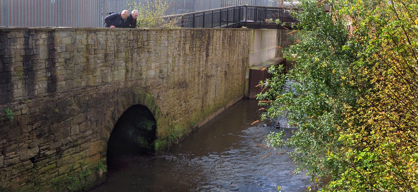
The footbridge by Saxon Road was closed last year while the Environment Agency strengthened a wall battered by recent floods. Mysterious rocks have now appeared, maybe to baffle the river into swirling rather than bludgeoning into the banks when the next floods come.
From the Saxon Road bridge, we can see the outlet of the Meers Brook. Simon tells me local explorer Patrick Dickinson posted a video here as he set out on a four hour pre-Christmas walk a few years ago along the dark culvert.
Patrick picks out features 260 years old during his damp winter stroll, but he notes that much of the Meers Brook was culverted in 1957. In those days, we tried to hide our rivers, but now people like Simon and Andy and a growing band of city river watchers are doing their best to draw our attention back to our rivers and riversides.
Heightening flood risk, biodiversity loss, and pollution are all driving interest from local and national government agencies too, but we need to do a lot more for our waterways, as evidenced in last week’s post when SPRT itemised the increases in Sheffield’s sewage pollution over the last year.
The old meandering Sheaf by The Primrose was canalised some years ago, and straightened, if not tamed. Now when it’s in flood the water thunders down alongside Broadfield Road, and crashes into the walls at either side. SPRT have been talking to the council and Environment Agency about ‘softening’ the river here, allowing vegetation to grow and maybe adding rocks and greener river banks that’ll help wildlife and slow the river flow, but there are no decisions yet.
Andy tells me there are also nature recovery schemes from Network Rail in the pipeline, which might involve local trackside rewilding near the Sheaf. It might make some amends, he says, for the Midland Railway’s determination to corral the Sheaf behind black stone walls when they built their new tracks 150 years ago.
Simon has long seen our rivers as an asset to provide space for recreation, reflection and public health. He’s been working for years to open up riverside paths and trails, and is now joined by hundreds of colleagues who also want the best from our rivers, badgering developers and the council to stitch together patches of pathways to eventually form uninterrupted trails along the Sheaf, Porter and Upper Don, to link to the existing Five Weirs Walk on the Lower Don.
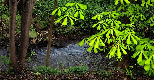
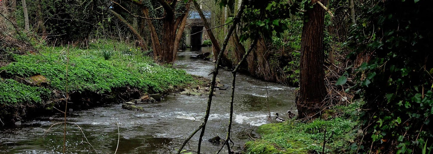
We stroll along a quiet unfinished pathway between the Sheaf and a Little London Road office estate. The river is flanked here by wood anemones and wild garlic, showing off its wet woodland heritage from long before water and coal powered industry came and went on its banks.
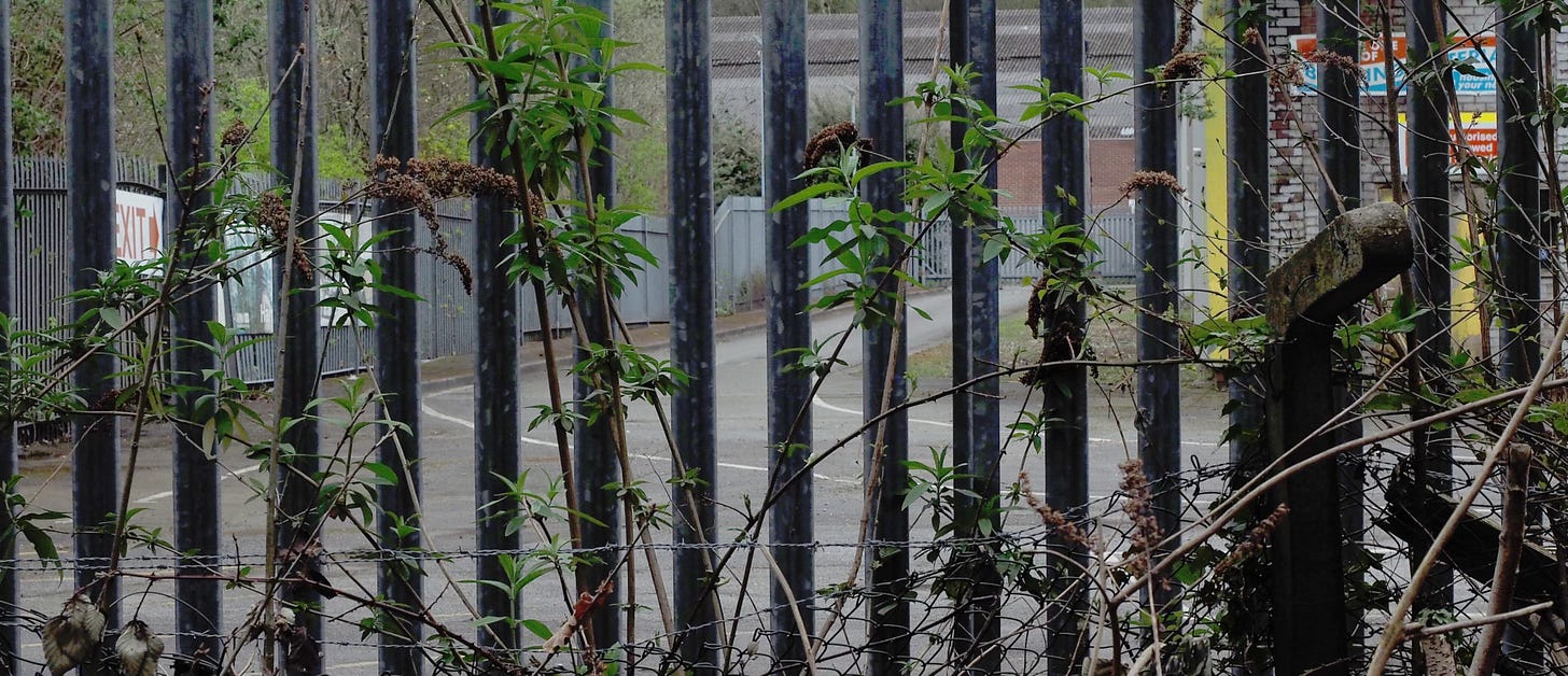
The old fence at the end of the path is broken and we stray into uncharted scrubland to see how the path could finally link with the new Sheaf Valley Active Travel route, if we could only remove the fence and add around 20 metres of pathway onto a grass verge in the old Lavers site, soon to become an indoor football attraction.
The new leaseholders, Tekkers, are happy to host the link path for the Sheaf Valley Trail, says Simon, but landlords Lavers are not so keen as yet, despite their local heritage in the area. Watch this space, just like SPRT have been doing for years.
Nowadays, a growing army of river rangers are watching out for our rivers. “People who already walk or cycle to work alongside a stretch of river, or visit during the day, maybe walking the dog, are ideal river watchers,” says Andy. By May, there’ll be 50 trained river rangers in the city, he says
Keeping an eye (and nose) out for pollution every week or so is useful citizen science, and as the river rangers scheme progresses there’ll also be the chance to monitor wildlife too. Counting certain river flies shows the ecological health of a river, and river rangers can be trained to get out there in their waders and do this too.
If you fancy being a river ranger the simplest approach is to contact (or ideally join) one of our main voluntary river groups: the Sheaf & Porter Rivers Trust, Rivelin Valley Conservation Group, Friends of the Loxley Valley, the Upper Don Trail Trust and the Don Catchment Rivers Trust are good starting points, and will usually be able to help you train up as a river ranger.
(If your local brook is not listed above, think of yourself as a tributary of the big river, so friends of Meers Brook might look to the Sheaf, whereas lovers of Wyming Brook should head down to the Rivelin).
We walk back downstream, and Simon points across the river to the innocuously titled ‘CSO’ looming under the bottom of the houses on Leyburn Road. What we’re viewing behind old metal railings strewn with plastic sewage debris and wet wipes is a Combined Sewer Overflow, which looks to me like two huge metal toilet seats.
Heavy rain runs into local drains and fills the nearby combined sewer. Then once the rain run off and sewage outflow overtops a nearby storage tank, the big toilet lids by the river are forced open and the sewage of Nether Edge pours into the Sheaf.
Just as it did at a public open day at the nearby Jamia Masjid Mosque last year, when the CSO near the mosque was overwhelmed by a downpour, and families had to endure the smell of sewage for the rest of the day. “It was horrible” says Andy.
Simon and Andy show me a patch of riverside land by the Broadfield Road playground that SPRT would like to buy, and hand back to the people of the city. Once an old workshop, the land owner has not yet agreed the sale, but that won’t stop the patient river trustees. If the kids of Millhouses can play by the Sheaf, why not the kids of Nether Edge?
Well, there’s those two big toilet lids. There’s a steep bank by the outflows at the end of Leyburn Road, presumably to discourage kids falling in to the sewage, says Simon. I imagine 1940s urchins looking down at the same overflow that we see now. Their parents or grandparents might remember playing in The Primrose meadow, but their own industrial neighbourhood was turning its back on the River Sheaf.
Now, Simon and Andy show me how a restaurant on Abbeydale Road has opened up its back yard to show off the river, and tell me how staff at the Jamia Masjid Mosque would love their community to see more greenery and wildlife along their riverside.
Finding ways to keep rainwater in the land and out of the combined sewer drain is part of the answer to our river sewage problem, along with modernising a system built for generations long past. Bringing people back to our rivers can only help water companies owned by foreign governments and pension schemes to act that little bit faster to clean up their mess.
Last year, the data shows those huge steel toilet lids opened for a total of 154 hours, and spilt sewage 45 times into the river by the Broadfield Road playground.
On The Verge
What are grass verges for? And who owns them? Sometimes people reckon they’re for gnomes, or wildflower displays, or parking your Sports Utility Vehicle. Although it’s complicated (see helpful comment from Sue below) their existence alongside the highway means we feel they belong to all of us, albeit they’re sort of overseen for that purpose by the council.
Quite often we ignore them: but ecologists tell me that insects, even small animals love them, at least if they’re left to grow into narrow meadows with native grasses and maybe even wild flowers. In places they become corridors to allow wildlife and biodiversity to spread around the city.
So what if someone decides their home or garden needs to expand into a nearby grass verge? What if they submit careful plans, including native trees, that make it hard for the council to say no, given the current developer-friendly nature of planning laws and desperate lack of public finances and resources?
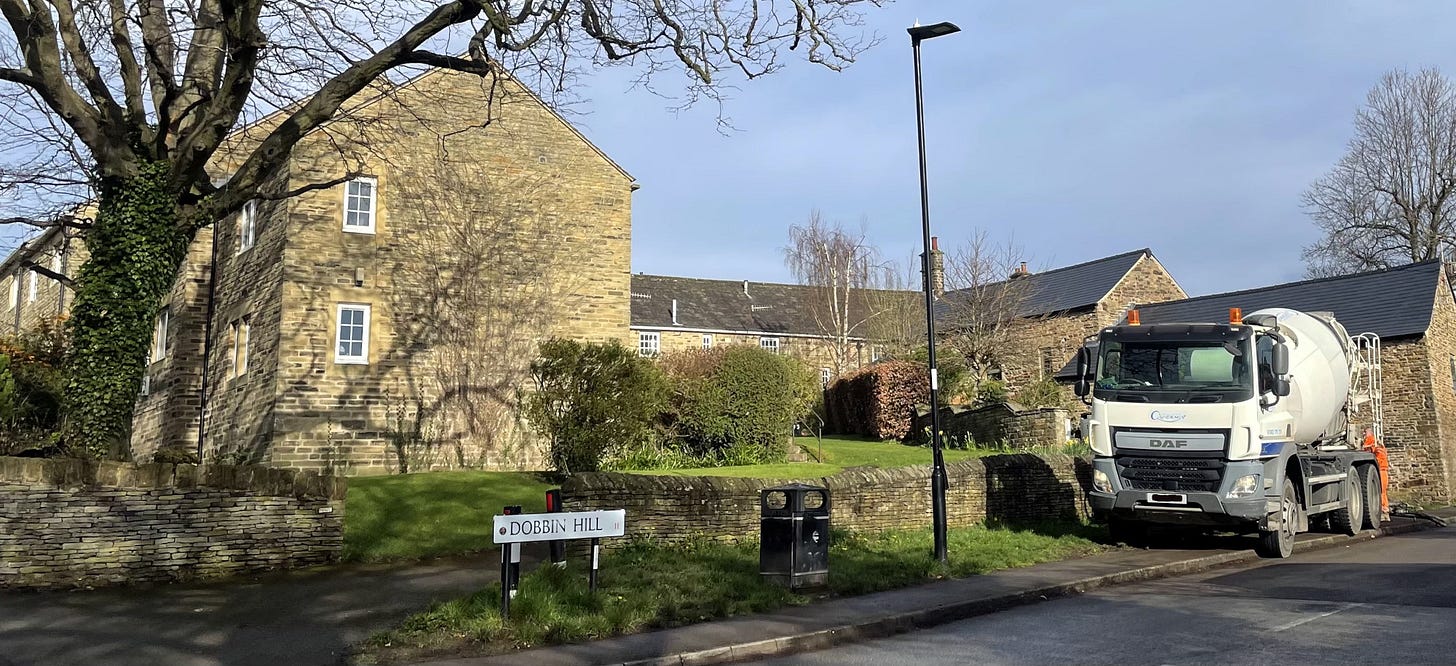
Last week, residents of Dobbin Hill in Ecclesall learned that a plan to annexe 75% of a very old grass verge (possibly dating back to previous farmland), so the landowner could build an extension to their garden seemed to have been conditionally granted.
Since 31 objections had been received to the plans (and one comment in support) they questioned the decision, and set about planting flowers on the verge to show that the site was valued by locals.
Their flowers were soon run over by a station wagon, then crushed by a skip, and finally by a concrete mixer and spraying machine. The residents say they also had an altercation with someone from the property, who became quite angry, and took a phone being used to video the scene, which was later returned.
(I’ve asked the developer for his view of the matter, but he’s not yet responded.)
The residents say they’ve been left upset and angry by the whole thing, and are asking their local councillors to intervene, not least to ask the council why they’d think of selling off valued public land that could be an asset for local people and wildlife?
And they also wonder what precedent the sale will set? If this piece of public land is sold off to widen someone’s garden, how can the rest of our grass verges stay ours, for our wildflowers, gnomes, and our nature emergency plan? Could we see all kinds of land grabs if this one goes ahead? (There seems some doubt whether the decision is yet final however.)
I’ll do my best to keep you posted. Not least if a tank arrives on the verge next week.
Selected What’s On Out There (from Sun 7th April)
See our full listings service here. It’s updated all the time. What great value!
Sun 7th - History Tour at Sheffield General Cemetery (£5)
Mon 8th - Thurs 11th - ‘Monster’ Crafts and Trail at Manor Lodge (£4.75 / child)
Tues 9th - Sheffield Ramblers Walk - Hope Valley (6.5m - meet Sheffield bus station)
Weds 10th - Social Walk from Longshaw (5m)
Thurs 11th - Friends of Porter Valley work morning
Thurs 11th - Graves Park Digging Deeper For All - Recording Birds
Thurs 11th- Tues16th - Sheffield BID Easter Egg Hunt in City Centre
Sat 13th - SRWT Young People's Woodland Conservation- Greno Woods
Sat 13th - Graves Park Digging Deeper For All - Heritage Walk
Sun 14th - Steel City Trail 10 - 10km (approx) trail run at Whirlow
Thanks for reading. I hear the average UK person’s spending on savoury snacks (a.k.a. crisps) is almost exactly the same as an annual subscription to It’s Looking A Bit Black Over Bill’s Mother’s. We’re much better for you, and come in far more flavours.
Remember, readers! F.F.S! Forward to Friends, and Subscribe!
:






A useful explanation Sue - many thanks for that. The Millhouses Ecclesall & Carter Knowle [MECK] Community Group objected to the Planning Application by the property-owner, and is still concerned that the implications for traffic safety and the loss of local green space were not adequately considered.
We have written to the Chairs of the Finance and Strategy & Resources Committees to object to the stopping-up of this part of the highway, and to the sale of the verge to the property-owner, on the grounds that
a) the legislation [the Town and County Planning Act, 1990] does not compel the Secretary of State to approve such an order, but "may" do so; and only for the purpose of improving or extending the highway. That does not cover such a land-grabas this, purely for the sake of extending someone's garden!
b) the Council does not have to sell the verge in such a case: and doing so purely fo that purpose does have considerable implications for the thousands of other sections of grass-verge around the city - implications that we feel have not been considered, and which should be discussed by the relevant Committee and approved as part of a general Council Policy.
Mike Hodson, MECK CG Secretary.
Great pieces as usual. I always thought the City of Rivers Waterways Strategy was an inspired piece of work - more than a decade old now https://www.sheffield.gov.uk/sites/default/files/docs/planning-and-development/conservation/Sheffield%20Waterways%20Strategy.pdf
It seems to be that SCC has forgotten about their collaborative work when it comes to planning applications. Great that Simon, Andy and all the volunteers are still chipping away at all the small waterways connections while keeping an eye on the bigger picture.